The Buckley Draw Fire in Provo, Utah, has burned 400 acres and is growing fast. Get updates on firefighting efforts, safety alerts, and aerial drops.
🚨 Buckley Draw Fire: A Growing Threat in Utah County

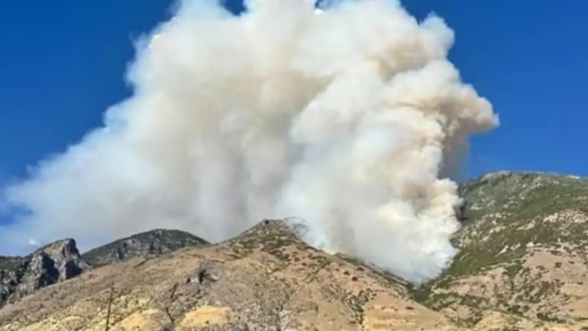
The Buckley Draw Fire erupted Sunday evening in the mountains above Provo, quickly spreading across 400 acres of dry grass and brush. First reported around 5:15 p.m., the wildfire has been fueled by Utah’s hot summer conditions, visible across the valley in massive plumes of smoke.
The U.S. Forest Service confirmed the fire is burning on Forest Service land south of Slate Canyon. Local residents in Provo Valley are urged to remain alert as the fire spreads. Buckley Draw Fire in Provo
📍 Location and Key Facts About the Buckley Draw Fire
| Detail | Information |
|---|---|
| Fire Name | Buckley Draw Fire |
| Location | Buckley Draw Canyon, east of Provo, Utah |
| First Reported | August 17, ~5:15 p.m. |
| Size | 400 acres (and expanding) |
| Terrain | Dry brush and grasslands |
| Agencies Responding | U.S. Forest Service, Provo Fire, Utah County Fire |
| Evacuations | None as of Sunday night |
| Air Support | Helicopters and firefighting aircraft |
🛩️ Firefighting Efforts on the Buckley Draw Fire in Provo
Aerial Response
Helicopters and fixed-wing aircraft are dropping water and fire retardant along the fire’s edges to slow its advance.
Ground Crews
Firefighters from Provo Fire and Utah County Fire are working aggressively on the ground to contain the blaze.
Public Warnings
Authorities stress the importance of staying away from Slate Canyon and Mountain View Parkway. Drone activity is strictly prohibited near wildfires—if drones appear, aircraft must land, jeopardizing firefighting progress.
🌡️ Why the Buckley Draw Fire in Provo Spread So Quickly
The Buckley Draw Fire grew to 400 acres in just hours due to several contributing factors:
- Dry grass & brush: Highly flammable and abundant in the canyon.
- Wind gusts: Pushed flames into new terrain rapidly.
- Steep slopes: Fires naturally move uphill faster.
- High summer heat: Prolonged drought in Utah worsens conditions.
🏡 Community Impact: What Residents Should Know
As of now, no neighborhoods are under evacuation. However, wildfire officials advise residents to:
- Stay away from the Slate Canyon area.
- Be prepared with evacuation kits in case conditions change.
- Monitor official updates from the U.S. Forest Service and Provo City.
🔥 Buckley Draw Fire in Context: Utah’s Wildfire Season
Utah’s wildfire season has been intensifying over the past decade. The Buckley Draw Fire in Provo is the latest in a series of summer blazes across the state, underscoring the risks of hot, dry summers.
Experts note that August and September are peak wildfire months, with the driest vegetation and frequent thunderstorms capable of sparking new fires.
📢 Latest Updates on the Buckley Draw Fire in Provo
- Fire growth: 400 acres burned as of Sunday night.
- Firefighting: Aircraft and ground crews remain active.
- Safety: No evacuations but residents are urged to remain alert.
- Air quality: Smoke is affecting nearby communities in Utah Valley.
❓ FAQs About the Buckley Draw Fire
1. Where is the Buckley Draw Fire located?
It is burning south of Slate Canyon in Buckley Draw Canyon, east of Provo, Utah.
2. How large is the fire?
The fire has scorched 400 acres so far, with potential for further spread.
3. Are there evacuation orders?
No evacuation orders have been issued yet, but officials are monitoring conditions closely.
4. Who is fighting the fire?
The U.S. Forest Service, Provo Fire, and Utah County Fire are leading suppression efforts.
5. Why are drones banned near the fire?
Flying drones in wildfire zones is illegal and dangerous because they can force aerial firefighting aircraft to land.
✅ Conclusion
The Buckley Draw Fire in Provo is a fast-growing wildfire that has already burned 400 acres and continues to spread. With aerial and ground crews fighting aggressively, officials are working to protect communities and contain the flames.
Public cooperation remains vital—residents must avoid the fire area, follow safety alerts, and stay updated through official wildfire information channels.