

August rain records smashed across NSW, with over 20 towns breaking historical rainfall marks. Sydney faces one of its wettest Augusts, dams are spilling, and emergency warnings are in place as thunderstorms loom.

Introduction
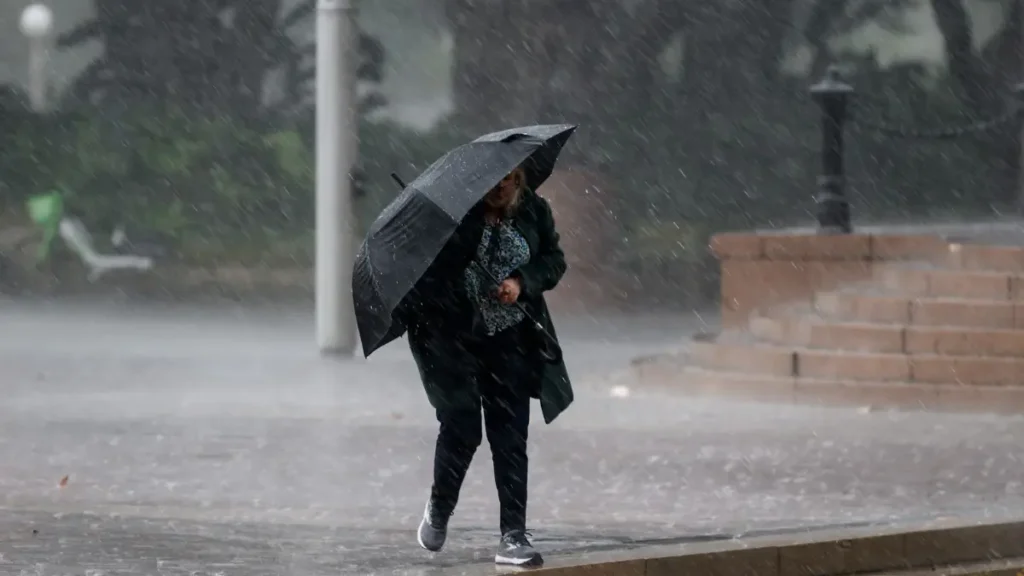
This August, New South Wales is witnessing an extraordinary weather event as August rain records smashed across NSW in multiple regions. Over 20 towns have already exceeded their highest August rainfall totals, with more rain records expected in the coming week. Meteorologists say the combination of cold fronts, thunderstorms, and saturated soils is creating a rare scenario of extreme rainfall and flooding across the state.
From Sydney’s overflowing dams to Northern Rivers and Hunter Valley communities facing unprecedented rainfall, this month’s weather has set historical benchmarks. Climatologists warn that these trends may persist into spring, with above-average rainfall forecast across much of NSW.
August rain records smashed across NSW
Collaroy and Norah Head Break Rain Records
In Collaroy, northern Sydney, rainfall reached 413.5 mm, shattering the 2014 record of 215 mm and more than six times the August average of 62 mm. Similarly, Norah Head on the Central Coast recorded 403.8 mm, exceeding its previous 218.2 mm record. These figures highlight the extreme weather impacting coastal areas, affecting infrastructure, transport, and daily life.
Hunter Valley and Mid North Coast Shattered Rain Records
Upper Allyn, in the Hunter region, received 277 mm, surpassing its previous 1987 record of 202 mm. The town normally averages just 46 mm in August. Meanwhile, Taree Airport reached 240 mm, beating the 1998 record of 151 mm. Communities across the Hunter and Mid North Coast have reported rainfall totals double or triple their usual averages.
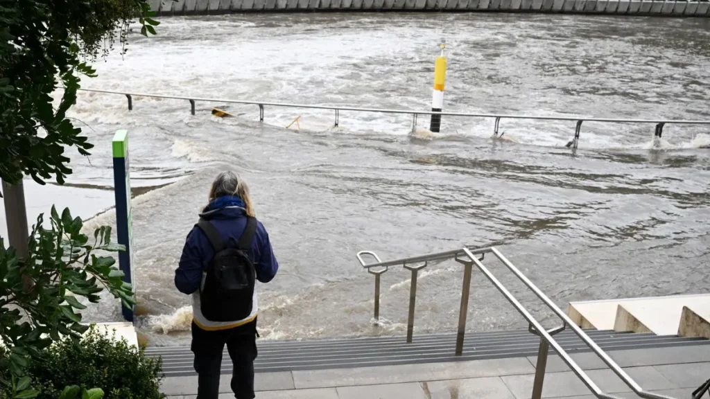
Sydney on Track for One of Wettest Augusts
Sydney has recorded Rain Records of 368.8 mm by August 22, positioning it among the top wettest Augusts in 168 years of recorded weather data. Only 1899 (378.3 mm), 1986 (470.6 mm), and 1998 (482.6 mm) were wetter. With more rain forecast, Sydney could move even higher on this list, intensifying the strain on local infrastructure and emergency services.
Flood Warnings and Emergency Alerts
Rivers Under Watch
Flood warnings remain in effect for multiple rivers, including the Namoi, Hawkesbury, Colo, Wollombi, Orara, and Gwydir Rivers. Communities along these waterways, including Gunnedah and Boggabri, are under “watch-and-act” advisories, urging residents to stay alert for potential flooding.
SES Responds to Record Incidents
The State Emergency Service (SES) has been overwhelmed, responding to more than 1,019 incidents, including 16 flood rescues in just one week. Volunteers continue to assist residents with property protection, evacuations, and post-flood cleanups.
Daily Rainfall Records
Several locations have also set daily rain records for August:
- Kingscliff received 126 mm in 24 hours, surpassing last year’s record of 94 mm.
- Wombat Street, Blackheath, recorded 64 mm, exceeding the previous 55 mm record set in 2020.
Sydney Dams Reach Full Capacity
Warragamba Dam Spilling
Sydney’s Warragamba Dam reached 100% capacity and began spilling 30 gigalitres per day. Despite the high volume, authorities do not expect significant downstream flooding, thanks to controlled releases and monitoring.
Other Dams Overflowing
Smaller dams, including Woronora, Cataract, Cordeaux, Nepean, Avon, Wingecarribee, and Tallowa are also spilling. These events demonstrate the extraordinary scale of rainfall impacting Greater Sydney and nearby regions.
Meteorologists Warn of More Rain
Cold Fronts Expected
The Bureau of Meteorology (BoM) forecasts several cold fronts crossing NSW in the coming week. These systems are expected to bring further thunderstorms, heavy rain, and localized flooding, potentially pushing rainfall totals even higher.
Weatherzone Predictions
Weatherzone meteorologists anticipate Sydney could end August among the top three wettest months in history, depending on rainfall totals for the remainder of the month.
Spring Rainfall Outlook
Climatologists warn that the wet conditions may continue into spring, particularly in October, which is expected to experience above-average rainfall across most of NSW. Communities are advised to remain vigilant, given the already saturated catchments and overflowing rivers.
Climate Change and Extreme Weather
Connection to Warmer Oceans
Experts link these extreme rainfall events to climate change, noting that warmer oceans increase evaporation rates, which in turn intensifies storms and rainfall.
Rising Frequency of Extreme Events
Australia has seen numerous extreme weather events in recent years, including record floods in Queensland, intense heatwaves in Victoria, and now historic rainfall in NSW. These events are consistent with global climate trends indicating more frequent and severe extreme weather events.
Preparing for Future Floods
Authorities encourage residents and local councils to strengthen flood preparedness measures, including:
- Maintaining drainage and levee systems
- Monitoring river levels
- Developing emergency evacuation plans
- Staying updated via Bureau of Meteorology alerts
August rain records smashed across NSW Rainfall Records Table
| Location | August 2025 Rainfall (mm) | Previous Record (mm) | Average August Rainfall (mm) |
|---|---|---|---|
| Collaroy | 413.5 | 215 (2014) | 62 |
| Norah Head | 403.8 | 218.2 (2014) | 62 |
| Upper Allyn | 277 | 202 (1987) | 46 |
| Taree Airport | 240 | 151 (1998) | 44 |
| Sydney | 368.8 | 470.6 (1986) | 100 (approx.) |
| Kingscliff | 126 (24 hrs) | 94 (2024) | 60 |
| Wombat Street | 64 (24 hrs) | 55 (2020) |
FAQs August rain records smashed across NSW
Q1: Which towns in NSW broke rainfall records in August 2025?
Over 20 towns, including Collaroy, Norah Head, Upper Allyn, and Taree Airport, set new August rainfall records.
Q2: How much rain has Sydney received this August?
Sydney recorded 368.8 mm as of August 22, placing it among the wettest Augusts in the city’s history.
Q3: Are dams in Sydney overflowing?
Yes. Warragamba and several smaller dams are spilling due to record rainfall, though authorities report no major downstream flooding.
Q4: What is the forecast for NSW next week?
The Bureau of Meteorology predicts more cold fronts, thunderstorms, and heavy rainfall in the coming week.
Q5: Will NSW have above-average rainfall in spring 2025?
Yes. Meteorologists predict above-average rainfall, with October particularly likely to experience high precipitation.
Q6: How is climate change affecting rainfall in NSW?
Warmer oceans increase evaporation, leading to heavier, more frequent rainfall events, consistent with global climate trends.